
Woods Hole Science Center
Surficial Geology in Central Narragansett Bay, Rhode Island: Interpretations of Sidescan Sonar and Multibeam Bathymetry
![]() Title |
Introduction |
Geologic Setting |
Data Acquisition/Processing |
Multibeam Bathymetry |
Sidescan Sonar |
Sediment Distribution |
Environments |
Summary |
GIS Data Catalog |
Acknowledgments |
References |
Figures |
Contacts
Title |
Introduction |
Geologic Setting |
Data Acquisition/Processing |
Multibeam Bathymetry |
Sidescan Sonar |
Sediment Distribution |
Environments |
Summary |
GIS Data Catalog |
Acknowledgments |
References |
Figures |
Contacts
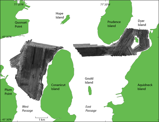 |
Figure 5. Sidescan sonar image of study area. Dark tones indicate low backscatter and generally finer grained sediment; light tones indicate high backscatter and generally coarser grained sediment. Tonal changes are generally gradual, although abrupt changes occur in areas, such as the northern edge of the West Passage study area, due to artifacts of the processing. |

