SEISMICLINES- Survey Lines along which seismic data were collected aboard R/V RAFAEL (field activities 05001 and 06001) in Apalachicola Bay, FL

Metadata also available as - [Outline] - [Parseable text]

Frequently-anticipated questions:


What does this data set describe?

Title:
SEISMICLINES- Survey Lines along which seismic data were collected aboard R/V RAFAEL (field activities 05001 and 06001) in Apalachicola Bay, FL
Abstract:
These data were collected under a cooperative mapping program between the U.S. Geological Survey (USGS), the National Oceanic and Atmospheric Administration Coastal Services Center (NOAA\CSC), and the Apalachicola National Estuarine Research Reserve (NERR). The primary objectives of this program were to collect marine geophysical data to develop a suite of seafloor maps to better define the extent of oyster habitats, the overall seafloor geology of the bay and provide updated information for management of this resource. In addition to their value for management of the bay's oyster resources, the maps also provide a geologic framework for scientific research and the public.
High-resolution bathymetry, backscatter intensity, and seismic profile data were collected over 230 square kilometers of the floor of the bay. The study focused on the Apalachicola Bay and Western St. George Sound portions of the estuary in mostly in depths > 2.0 meters.
  1. How should this data set be cited?

    U.S. Geological Survey, 2007, SEISMICLINES- Survey Lines along which seismic data were collected aboard R/V RAFAEL (field activities 05001 and 06001) in Apalachicola Bay, FL: Open-File Report 2006-1381, U.S. Geological Survey, Coastal and Marine Geology Program, Woods Hole Science Center, Woods Hole, Massachusetts.

    Online Links:

    This is part of the following larger work.

    Twichell, David C. , Andrews, Brian D. , Edmiston, H. Lee , and Stevenson, William R. , 2007, Geophysical Mapping of oyster habitats in a shallow estuary; Apalachicola Bay, Florida: Open-File Report 2006-1381, U.S. Geological Survey, Coastal and Marine Geology Program, Woods Hole Science Center, Woods Hole, Massachusetts.

    Online Links:

  2. What geographic area does the data set cover?

    West_Bounding_Coordinate: -85.095776
    East_Bounding_Coordinate: -84.755209
    North_Bounding_Coordinate: 29.782852
    South_Bounding_Coordinate: 29.601378

  3. What does it look like?

    <http://pubs.usgs.gov/of/2006/1381/GIS/thumbnails/SeismicLines.jpg> (JPEG)
    JPEG image of seismic tracklines

  4. Does the data set describe conditions during a particular time period?

    Beginning_Date: 14-Mar-2005,20060529
    Ending_Date: 13-Apr-2005,20060627
    Currentness_Reference: ground condition

  5. What is the general form of this data set?

    Geospatial_Data_Presentation_Form: vector digital data

  6. How does the data set represent geographic features?

    1. How are geographic features stored in the data set?

      This is a Vector data set. It contains the following vector data types (SDTS terminology):

      • String (717)

    2. What coordinate system is used to represent geographic features?

      Horizontal positions are specified in geographic coordinates, that is, latitude and longitude. Latitudes are given to the nearest 0.000000. Longitudes are given to the nearest 0.000000. Latitude and longitude values are specified in Decimal degrees.

      The horizontal datum used is D_WGS_1984.
      The ellipsoid used is WGS_1984.
      The semi-major axis of the ellipsoid used is 6378137.000000.
      The flattening of the ellipsoid used is 1/298.257224.

  7. How does the data set describe geographic features?

    SeismicLines
    Navigation lines for seismic-reflection data collected during USGS field activities 06001 and 05001 (Source: USGS)

    FID
    Internal feature number. (Source: ESRI)

    Sequential unique whole numbers that are automatically generated.

    Shape
    Feature geometry. (Source: ESRI)

    Coordinates defining the features.

    FeatureID
    Not used (Source: ArcMarine)

    FeatureCod
    not used

    LineName
    name of survey line assigned for identification purposes (Source: USGS)

    JDay
    Julian Day the data were collected (Source: USGS)

    ImageTitle
    Name of seismic profile image that coincides with the survey line. The LineName and ImageTitle are the same. (Source: USGS)

    SurveyID
    ID used to identify the survey during which the data were collected. It is also used as join field with SurveyInfo Table for relationship class (Source: USGS)

    ValueDefinition
    1USGS field activity 05001 conducted in 2005
    2USGS field activity 06001 conducted in 2006

    VehicleID
    Identification number identifying vehicle (survey platform) used to collect the data. Used as join field in relationship class to VehicleInfo table (Source: USGS)

    ValueDefinition
    1USGS Research Vessel RAFAEL

    DeviceID
    Identification number used to distinguish the type of acoustic sensor (Device) used to collect the data. Also used as join field for relationship class to MeasuringDevice Table object (Source: USGS)

    ValueDefinition
    3EdgeTech FSSB-424 chirp profiles (4-24 kHz)
    5Knudsen 320b chirp system (3.5-12 kHz)

    SHAPE_Leng
    Length of trackline in meters (Source: ESRI)


Who produced the data set?

  1. Who are the originators of the data set? (may include formal authors, digital compilers, and editors)

  2. Who also contributed to the data set?

  3. To whom should users address questions about the data?

    Brian Andrews
    U.S. Geological Survey
    Geographer
    384 Woods Hole Rd
    Woods Hole, MA 02543-1598
    USA

    508-548-8700 x2348 (voice)
    508-457-2310 (FAX)
    bandrews@usgs.gov


Why was the data set created?

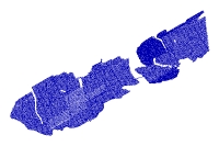
This shapefile represents the trackline along which seismic profile data collected aboard the R/V RAFAEL during USGS field activities 05001 and 06001 in Apalachicola Bay and St. George Sound, Florida. The seismic data that were collected from the R/V RAFAEL were acquired differently in 2005 than in 2006. During the first seven survey days of the 2005 field season (Julian days 076-083) a Knudsen 320 b chirp profiler (3.5-12 kHz) was used and during the remaining part of the 2005 season a towed Edgetech FSSB 424 (2-24 kHz) system was used. In 2006, the Edgetech FSSB 424 was used for the entire field season, but it was mounted on a pole rather than being towed on a cable. In 2005 both the Knudsen and Edgetech seismic data were logged in SEG-Y format using Delph Seismic +. In 2006 the Edgetech seismic data were logged in SEG-Y format using SBLogger. The purpose of these data is to manage the filenames and geographic locations of seismic profile images that are hyperlinked to each trackline.


How was the data set created?

  1. From what previous works were the data drawn?

  2. How were the data generated, processed, and modified?

    Date: 05-May-2007 (process 1 of 2)
    The seismic data that were collected from the R/V RAFAEL were acquired differently in 2005 than in 2006. During the first seven survey days of the 2005 field season (Julian days 076-083) a Knudsen 320 b chirp profiler (3.5-12 kHz) was used and during the remaining part of the 2005 season a towed Edgetech FSSB 424 (2-24 kHz) system was used. In 2006, the Edgetech FSSB 424 was used for the entire field season, but it was mounted on a pole rather than being towed on a cable. In 2005 both the Knudsen and Edgetech seismic data were logged in SEG-Y format using Delph Seismic +. In 2006 the Edgetech seismic data were logged in SEG-Y format using SBLogger. Navigation was extracted from the raw SEG-Y format seismic data and converted to an ASCII text file. The ASCII navigation file was downsampled to a one minute interval, and then imported to ArcGIS using the AddXYdata tool in ArcMap (v. 9.2). The points then were converted to a line using an ArcMap script Points_to_Line v2 developed at the USGS by VeeAnn Cross.

    Person who carried out this activity:

    Brian Andrews
    U.S. Geological Survey
    Geographer
    384 Woods Hole Rd.
    Woods Hole, MA 02543-1598
    USA

    508-548-8700 x2348 (voice)
    508-457-2310 (FAX)
    bandrews@usgs.gov

    Date: Jul-2007 (process 2 of 2)
    Exported feature class from personal geodatabase to a shapefile and projected to geographic.

    Person who carried out this activity:

    Brian Andrews
    U. S. Geological Survey
    Geographer
    384 Woods Hole Road
    Woods Hole, MA 02543-1598

    508-548-8700 x 2348 (voice)
    508-457-2310 (FAX)
    bandrews@usgs.gov

  3. What similar or related data should the user be aware of?


How reliable are the data; what problems remain in the data set?

  1. How well have the observations been checked?

    RTK GPS was used to navigate the seismic-reflection systems. The GPS antenna was mounted over the bathymetric sonar and a layback of 4 meters was used for the seismics.

  2. How accurate are the geographic locations?

    Navigation was recorded to all data acquisition systems using Real Time Kinematic GPS at a one second interval.
    Horizontal accuracy of the navigation is assumed to be +/- 1 meter. The shot point file and survey line file for the
    seismic data are both derived from the same navigation file that was logged by the seismic acquisition system, but
    because the two were processed differently, the shot points do not always fall directly on the survey line. To create
    the shot point file, the navigation was queried to extract every 500th point starting with shot point 500. By
    contrast, to create the survey line file, the navigation was queried at a one minute interval (every 60th point), and
    then a line was drawn using these points. Because of the different processing approaches, many of the shot points,
    although close, do not fall exactly on the survey line. If meter accuracy is truely needed, it would be best to
    extract the navigation from the archived SEG-Y seismic files.

  3. How accurate are the heights or depths?

  4. Where are the gaps in the data? What is missing?

    Sections of tracklines where seismic data were not logged were deleted

  5. How consistent are the relationships among the observations, including topology?


How can someone get a copy of the data set?

Are there legal restrictions on access or use of the data?

Access_Constraints: None
Use_Constraints:
These data should not be used at resolutions for which they are not intended.
Public domain data from the U.S. Government are freely redistributable with proper metadata and source attribution. Please recognize the U.S. Geological Survey (USGS) as the source of this information.

  1. Who distributes the data set? (Distributor 1 of 1)

    Brian Andrews
    U.S. Geological Survey
    Geographer
    384 Woods Hole Rd.
    Woods Hole, MA 02543-1598
    USA

    508-548-8700 x2348 (voice)
    508-457-2310 (FAX)
    bandrews@usgs.gov

  2. What's the catalog number I need to order this data set?

    Downloadable Data

  3. What legal disclaimers am I supposed to read?

    Although this data set has been used by the U.S. Geological Survey (USGS), no warranty, expressed or implied, is made by the USGS as to the accuracy of the data and/or related materials. The act of distribution shall not constitute any such warranty, and no responsibility is assumed by the USGS in the use of these data or related materials.
    Any use of trade, product, or firm names is for descriptive purposes only and does not imply endorsement by the U.S. Government.

  4. How can I download or order the data?

  5. What hardware or software do I need in order to use the data set?

    The data are available in Environmental Systems Research Institute (ESRI) shapefile format. The user must have ArcGIS or ArcView 3.3 or greater software to read and process the data file. In lieu of ArcView or ArcGIS, the user may utilize another GIS application package capable of importing data. A free data viewer, ArcExplorer, capable of displaying the data is available from ESRI at www.esri.com.


Who wrote the metadata?

Dates:
Last modified: 30-Aug-2007
Metadata author:
U.S. Geological Survey
c/o Brian Andrews
Geographer
384 Woods Hole Rd.
Woods Hole, MA 02543-1598
USA

508-548-8700 x2348 (voice)
508-457-2310 (FAX)
bandrews@usgs.gov

Metadata standard:
FGDC Content Standards for Digital Geospatial Metadata (FGDC-STD-001-1998)
Metadata extensions used:


Generated by mp version 2.9.2 on Thu Aug 30 14:18:44 2007