USGS Coastal and Marine Geology Program
![]() Title |
Figures |
1-Introduction |
2-Data Collection and Processing |
3- Geologic Interpretation |
4-References |
5-Maps |
Spatial Data |
Acknowledgments
Title |
Figures |
1-Introduction |
2-Data Collection and Processing |
3- Geologic Interpretation |
4-References |
5-Maps |
Spatial Data |
Acknowledgments
 |
||
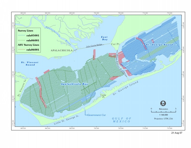
Figure 3. Map showing geophysical track lines occupied by R/V Rafael and Autonomous Surface Vehicle IRIS during survey cruises in 2005 and 2006. | ||
