
Woods Hole Science Center
Geologic Interpretation and Multibeam Bathymetry of the Sea Floor in the Vicinity of the Race, Eastern Long Island Sound
![]() Title |
Introduction |
Setting |
Methods |
Results |
Discussion |
Data Catalog |
Acknowledgments |
References |
Figures |
Contacts
Title |
Introduction |
Setting |
Methods |
Results |
Discussion |
Data Catalog |
Acknowledgments |
References |
Figures |
Contacts
 |
||
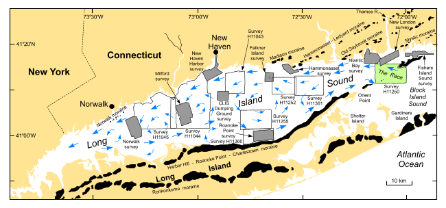
Figure 1. Map showing location of the study area (green polygon). Also shown are major onshore moraines, the sites of other interpreted multibeam and sidescan sonar surveys (USGS: shaded polygons; NOAA: open polygons), and a generalized circulation model (blue arrows; Welsh, 1993). | ||


