
Woods Hole Science Center
Geologic Interpretation and Multibeam Bathymetry of the Sea Floor in the Vicinity of the Race, Eastern Long Island Sound
![]() Title |
Introduction |
Setting |
Methods |
Results |
Discussion |
Data Catalog |
Acknowledgments |
References |
Figures |
Contacts
Title |
Introduction |
Setting |
Methods |
Results |
Discussion |
Data Catalog |
Acknowledgments |
References |
Figures |
Contacts
 |
||
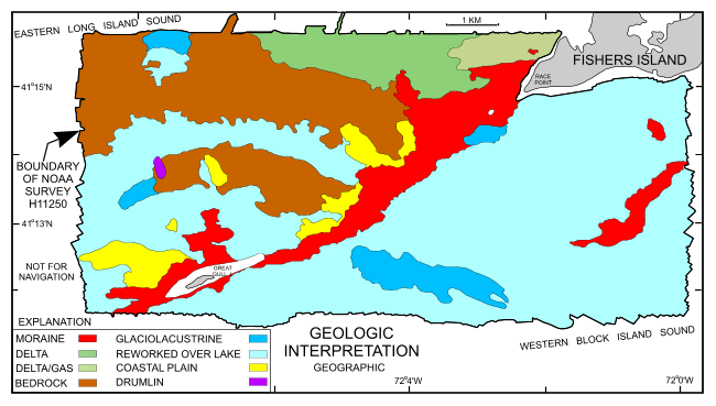
Figure 10. Interpretation of the geological units on the DTM. Image shows extent of exposed moraine, bedrock, glaciolacustrine, deltaic, and coastal plain deposits. Also shown are the distributions of reworked sediment over glacial lake deposits, deltaic deposits pock-marked by the release of biogenic gas, and a drumlin. | ||


