
Woods Hole Science Center
Geologic Interpretation and Multibeam Bathymetry of the Sea Floor in the Vicinity of the Race, Eastern Long Island Sound
![]() Title |
Introduction |
Setting |
Methods |
Results |
Discussion |
Data Catalog |
Acknowledgments |
References |
Figures |
Contacts
Title |
Introduction |
Setting |
Methods |
Results |
Discussion |
Data Catalog |
Acknowledgments |
References |
Figures |
Contacts
 |
||
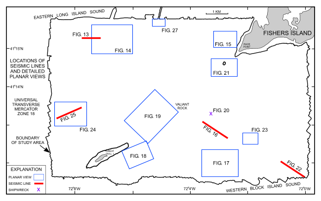
Figure 12. Map showing the boundary of the acoustic data from NOAA survey H11250 and locations of the detailed planar views of the multibeam DTM and the seismic lines shown in other figures. Planar views and seismic lines are labeled with their respective figure numbers. | ||


