
Woods Hole Science Center
Geologic Interpretation and Multibeam Bathymetry of the Sea Floor in the Vicinity of the Race, Eastern Long Island Sound
![]() Title |
Introduction |
Setting |
Methods |
Results |
Discussion |
Data Catalog |
Acknowledgments |
References |
Figures |
Contacts
Title |
Introduction |
Setting |
Methods |
Results |
Discussion |
Data Catalog |
Acknowledgments |
References |
Figures |
Contacts
 |
||
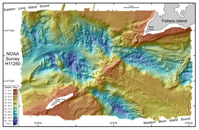
Figure 9. Digital terrain model (DTM) of the sea floor in eastern Long Island and western Block Island sounds produced from multibeam bathymetry data. Image is sun-illuminated from the north, and vertically exaggerated 8X. Colors trending toward red are shallower areas, and those trending toward blue are deeper areas. See key for depth ranges. | ||


