USGS Coastal and Marine Geology Program
Historical Shoreline Changes at Rincón, Puerto Rico, 1936-2006
| Title Page | Introduction | Methods | Historic Shoreline Changes |
Regional Bathymetry | Discussion | Future Outlook | Conclusion | Data Catalog | Acknowledgments | References |
 |
||
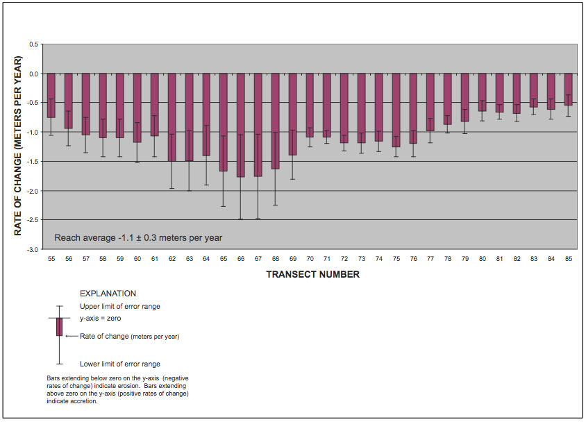
Figure 5. Graph showing alongshore spatial distribution of long-term (70 years from 1936-2006) rates of shoreline change for Reach B, Rincón, Puerto Rico study area. | ||
