
Woods Hole Science Center
Sea-Floor Character and Sedimentary Processes of Great Round Shoal Channel, Offshore Massachusetts
![]() Title |
Introduction |
Setting |
Methods |
Overview |
Discussion |
Interpretation |
Data Catalog |
Acknowledgments |
References |
Figures |
Bottom Photographs |
Sediment Data |
Contacts
Title |
Introduction |
Setting |
Methods |
Overview |
Discussion |
Interpretation |
Data Catalog |
Acknowledgments |
References |
Figures |
Bottom Photographs |
Sediment Data |
Contacts
 |
||
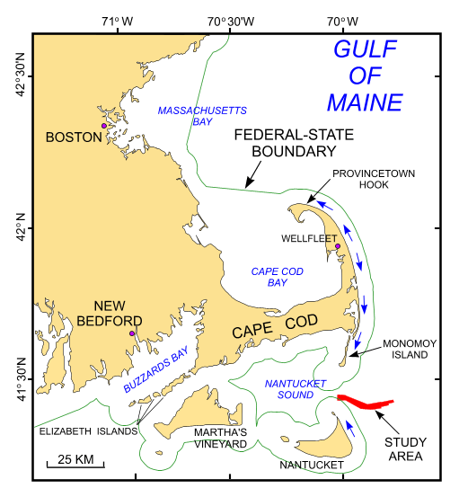
Figure 1. Index map of Cape Cod and the Islands showing location of the study area (red polygon). Blue arrows show directions of net sediment transport on the east-facing shores of Cape Cod and Nantucket (Strahler, 1988). | ||


