
Woods Hole Science Center
Sidescan-Sonar Imagery, Multibeam Bathymetry, and Surficial Geologic Interpretations of the Sea Floor in Rhode Island Sound, off Sakonnet Point, Rhode Island
![]() Title |
Introduction |
Geologic Setting |
Data Acquisition/Processing |
Bathymetry |
Sidescan-Sonar Imagery |
Environments |
Discussion |
Summary |
GIS Data Catalog |
Acknowledgments |
References |
Figures |
Contacts
Title |
Introduction |
Geologic Setting |
Data Acquisition/Processing |
Bathymetry |
Sidescan-Sonar Imagery |
Environments |
Discussion |
Summary |
GIS Data Catalog |
Acknowledgments |
References |
Figures |
Contacts
 |
||
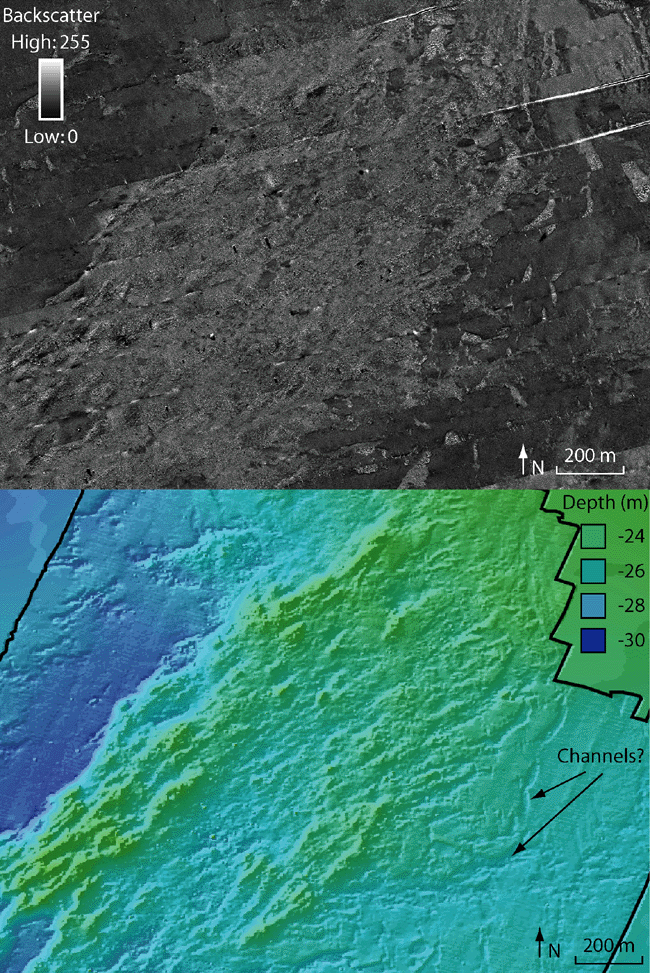
Figure 11. Detailed view of sidescan-sonar imagery showing mottled backscatter and corresponding bathymetry. Mottled backscatter in the sidescan-sonar data is caused by the hummocky surface of moraines and glacial till inconsistently reflecting backscatter due to the variable topography and sediment distribution. Possible channels, oriented toward the south and west, are visible in the bathymetry. Note: black line outlines high-resolution multibeam bathymetry which overlies bathymetry from the Coastal Relief Model. Figure location is shown in figure 2. | ||

