
Woods Hole Science Center
![]() Title |
Introduction |
Setting |
Methods |
Results |
Discussion |
Data Catalog |
Acknowledgments |
References |
Figures |
Contacts
Title |
Introduction |
Setting |
Methods |
Results |
Discussion |
Data Catalog |
Acknowledgments |
References |
Figures |
Contacts
 |
||
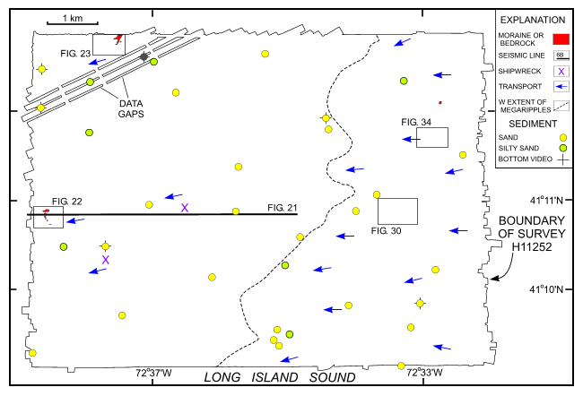
Figure 16. Geological interpretation of the sea-floor bathymetry from survey H11252 west of Six Mile Reef. Arrows show directions of net sediment transport based on sand-wave and scour-mark asymmetry. Also shown are locations of Chirp seismic profile shown in figure 21, and detailed multibeam views of the sea floor shown in figures 22, 23, 30, and 34. See inset for explanation of symbols. | ||


