
Woods Hole Science Center
![]() Title |
Introduction |
Setting |
Methods |
Results |
Discussion |
Data Catalog |
Acknowledgments |
References |
Figures |
Contacts
Title |
Introduction |
Setting |
Methods |
Results |
Discussion |
Data Catalog |
Acknowledgments |
References |
Figures |
Contacts
 |
||
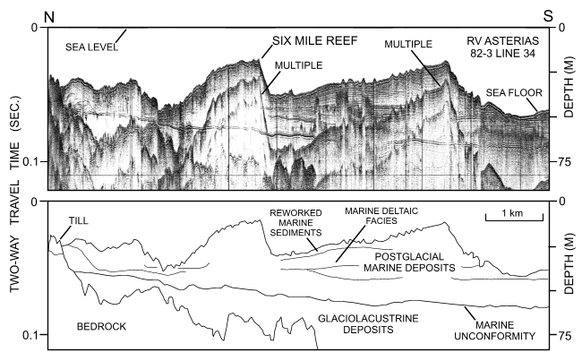
Figure 18. Uniboom seismic-reflection profile across the western part of Six Mile Reef (RV Asterias 82-3; line 34). Profile shows that postglacial marine deposits, composed of deltaic facies and reworked sediments, thicken westward. Interpretation of profile modified from Lewis and Needell (1987). Location of seismic profile is shown in figure 15. | ||


