
Woods Hole Science Center
Sidescan-Sonar Imagery and Surficial Geologic Interpretations of the Sea Floor in Central Rhode Island Sound
![]() Title |
Introduction |
Geologic Setting |
Data Acquisition/Processing |
Bathymetry |
Seismic Reflection Data |
Sidescan Sonar Imagery |
Environments |
Discussion |
Summary |
GIS Data Catalog |
Acknowledgments |
References |
Figures |
Contacts
Title |
Introduction |
Geologic Setting |
Data Acquisition/Processing |
Bathymetry |
Seismic Reflection Data |
Sidescan Sonar Imagery |
Environments |
Discussion |
Summary |
GIS Data Catalog |
Acknowledgments |
References |
Figures |
Contacts
 |
||
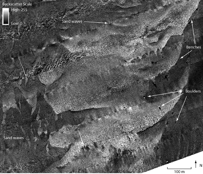
Figure 13. Detailed sidescan-sonar image of the southeastern part of the study area showing boulders, sand waves, and benches. Boulders are visible as high-backscatter targets with low-backscatter shadows. Higher backscatter (lighter tones) in the center of the image represents coarser grained sediment; lower backscatter (darker tones) represents finer grained sediment. Location of figure shown in fig. 2. | ||

