
Woods Hole Science Center
Sea-Floor Character and Sedimentary Processes in the Vicinity of Woods Hole, Massachusetts
![]() Title | Abstract | Introduction | Setting | Methods | Bathymetry and Backscatter | Seismic Profiles | Character and Processes | Data Catalog | Acknowledgments | References | Figures | Bottom Photography | Sediment Data | Contacts
Title | Abstract | Introduction | Setting | Methods | Bathymetry and Backscatter | Seismic Profiles | Character and Processes | Data Catalog | Acknowledgments | References | Figures | Bottom Photography | Sediment Data | Contacts
 |
||
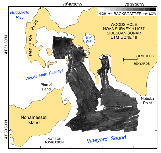
Figure 17. Map showing the sidescan-sonar imagery produced from data collected during National Oceanic and Atmospheric Administration survey H11077 of Woods Hole, Massachusetts. Hard returns (high backscatter) indicate generally coarser grained sediments; softer returns (low backscatter) indicate generally finer grained sediments. | ||


