
Woods Hole Science Center
Sea-Floor Character and Sedimentary Processes in the Vicinity of Woods Hole, Massachusetts
![]() Title | Abstract | Introduction | Setting | Methods | Bathymetry and Backscatter | Seismic Profiles | Character and Processes | Data Catalog | Acknowledgments | References | Figures | Bottom Photography | Sediment Data | Contacts
Title | Abstract | Introduction | Setting | Methods | Bathymetry and Backscatter | Seismic Profiles | Character and Processes | Data Catalog | Acknowledgments | References | Figures | Bottom Photography | Sediment Data | Contacts
 |
||
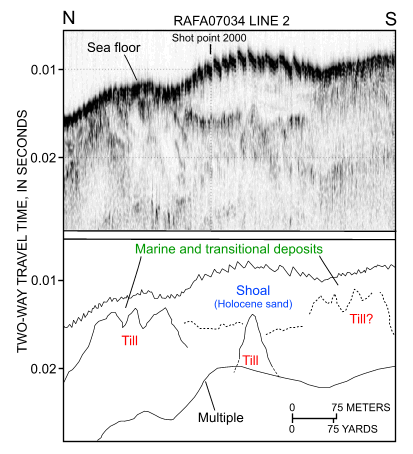
Figure 31. Segment of chirp high-resolution seismic-reflection profile and interpretation from cruise RAFA07034 line 2 across the shoal in the channel west of Great Ledge. Note that till forms acoustic basement and that the shoal is largely composed of Holocene sediment. Location of profile is shown in figure 11. | ||


