
Woods Hole Science Center
Sea-Floor Character and Sedimentary Processes in the Vicinity of Woods Hole, Massachusetts
![]() Title | Abstract | Introduction | Setting | Methods | Bathymetry and Backscatter | Seismic Profiles | Character and Processes | Data Catalog | Acknowledgments | References | Figures | Bottom Photography | Sediment Data | Contacts
Title | Abstract | Introduction | Setting | Methods | Bathymetry and Backscatter | Seismic Profiles | Character and Processes | Data Catalog | Acknowledgments | References | Figures | Bottom Photography | Sediment Data | Contacts
 |
||
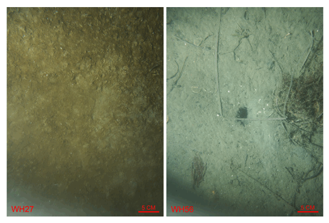
Figure 38. Bottom photographs from stations WH27 (left) and WH56 (right) showing the muddy sediment, organic mats, and burrows that are prevalent in areas characterized by sedimentary environments of long-term deposition. Station locations are shown in figure 12. | ||


