
Woods Hole Science Center
Sea-Floor Character and Sedimentary Processes in the Vicinity of Woods Hole, Massachusetts
![]() Title | Abstract | Introduction | Setting | Methods | Bathymetry and Backscatter | Seismic Profiles | Character and Processes | Data Catalog | Acknowledgments | References | Figures | Bottom Photography | Sediment Data | Contacts
Title | Abstract | Introduction | Setting | Methods | Bathymetry and Backscatter | Seismic Profiles | Character and Processes | Data Catalog | Acknowledgments | References | Figures | Bottom Photography | Sediment Data | Contacts
 |
||
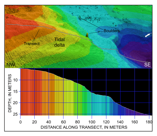
Figure 52. Detailed perspective view showing the tidal delta prograding from the eastern end of Broadway from the digital terrain model produced during National Oceanic and Atmospheric Administration survey H11077 of Woods Hole, Massachuestts. Line shows location of transect; cross section shows scaled bathymetry. Location of view is shown in figure 19. | ||


