
Woods Hole Science Center
Enhanced Sidescan-Sonar Imagery, North-Central Long Island Sound
![]() Title |
Introduction |
Data Acquisition |
Processing of Sidescan Sonar |
GIS Data Catalog |
Acknowledgments |
References |
Figures |
Contacts
Title |
Introduction |
Data Acquisition |
Processing of Sidescan Sonar |
GIS Data Catalog |
Acknowledgments |
References |
Figures |
Contacts
 |
||
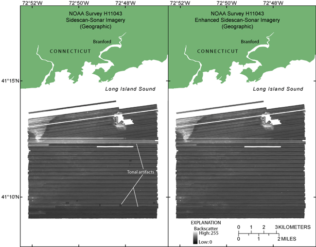
Figure 3. Sidescan-sonar imagery of National Oceanic and Atmospheric Administration survey H11043 (left) and enhanced imagery (right). Artifacts are still present in the enhanced imagery and might be due to a roll in the tow fish. Lighter tones represent higher backscatter and darker tones represent lower backscatter. Images are in geographic coordinate system. | ||


