
|
U.S. Geological Survey Open-File Report 02-002
Geological Framework Data from Long Island Sound, 1981-1990:
A Digital Data Release
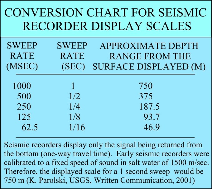
Conversion Chart for Seismic Recorder Display Scales
 |
||
| SWEEP RATE (MSEC) | SWEEP RATE (SEC) | APPROXIMATE
DEPTH RANGE FROM THE SURFACE DISPLAYED (M) |
| 1000 | 1 | 750 |
| 500 | 1/2 | 375 |
| 250 | 1/4 | 187.5 |
| 125 | 1/8 | 93.7 |
| 62.5 | 1/16 | 46.9 |
|
Seismic records display only the signal being returned from the bottom (one-way travel time). Early Seismic recorders were calibrated to a fixed speed of sound in salt water of 1500 m/sec. Therefore, the displayed scale for a 1 second sweep would be 750 m (K. Parolski, USGS, Written Communication, 2001). |
||