This ArcView shapefile represents the internal boundaries of the United States and the political boundaries between the US, Canada and Mexico.
Purpose:
This data layer includes the internal boundaries for the United States and the political boundaries of the US, Canada and Mexico. The state boundaries are drawn to the US coastline and does not include any coastline or islands. This data layer may be used with the high resolution NOS80K coastline (allus80k.shp) which does not include any internal boundaries.
Supplemental_Information:
This dataset was created to be used with the NOS80K coastline (allus80k.shp) to provide state bounds without redrawing the coastline. In creating the data layer, some issues of the NOS80K coastline became apparent. One example, is the US/Mexico boundary. The NOS80K coastline closes and draws a straight line well below the Texas border. The same type of problem can be seen around the US/Canada boundary of the Great Lakes. The state_bounds.shp will draw the political boundaries while the allus80k.shp file will display the US beyond the political boundaries. If this is unacceptable to the user, they should consider masking the annexed US possession.
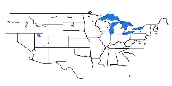
Image showing extent and coverage of the state_bounds shapefile with large US lakes.
Browse_Graphic_File_Type: GIF
Data_Set_Credit:
The true origin of this dataset is compiled from ESRI's 50 individual state 'trct' files. Please view the Source Information for more details
Native_Data_Set_Environment:
Microsoft Windows XP Version 5.1 (Build 2600) Service Pack 2; ESRI ArcCatalog 9.0.0.535
Data_Quality_Information:
Logical_Consistency_Report:
No additional checks for topological consistency were performed on this data set.
Completeness_Report:
This data set contains the internal boundaries for the continental US and the US/Canada and US/Mexico political boundaries.
Lineage:
Source_Information:
Source_Citation:
Citation_Information:
Originator: Valerie Paskevich
Publication_Date: Unpublished Material
Title: USA: United States basemap data layer
Edition: 1.0
Geospatial_Data_Presentation_Form: vector digital data
Type_of_Source_Media: disc
Source_Citation_Abbreviation: usa.shp
Source_Contribution:
The compiled usa.shp file was used as the source for this new data layer.
Process_Step:
Process_Description:
The usa.shp file was copied and edited to remove the coastline and islands. Because the file contained shapes for the individual states, duplicate common boundaries were numerous. The file was edited further to remove these duplicate shapes and remove the original table information. A final clean-up was done to combine (UNION) line segments and reduce the number of individual shapes.
Horizontal_Datum_Name: North American Datum of 1983
Ellipsoid_Name: Geodetic Reference System 80
Semi-major_Axis: 6378137.000000
Denominator_of_Flattening_Ratio: 298.257222
Entity_and_Attribute_Information:
Detailed_Description:
Entity_Type:
Entity_Type_Label: state_bounds.dbf
Entity_Type_Definition: Shapefile Attribute Table
Entity_Type_Definition_Source: ESRI
Attribute:
Attribute_Label: FID
Attribute_Definition: Internal feature number.
Attribute_Definition_Source: ESRI
Attribute_Domain_Values:
Unrepresentable_Domain:
Sequential unique whole numbers that are automatically generated.
Attribute:
Attribute_Label: Shape
Attribute_Definition: Feature geometry.
Attribute_Definition_Source: ESRI
Attribute_Domain_Values:
Unrepresentable_Domain: Coordinates defining the features.
Attribute:
Attribute_Label: ID
Attribute_Definition:
Assigned feature id and has no applicable relevenace to the data.
Attribute_Definition_Source: User Defined
Attribute:
Attribute_Label: LENGTH
Attribute_Definition: Length of line in native units
Attribute_Definition_Source: User Defined
Overview_Description:
Distribution_Information:
Distributor:
Contact_Information:
Contact_Organization_Primary:
Contact_Organization: U.S. Geological Survey
Contact_Address:
Address_Type: mailing and physical address
Address: 384 Woods Hole Road
City: Woods Hole
State_or_Province: MA
Postal_Code: 02543-1598
Country: USA
Contact_Voice_Telephone: (508) 548-8700
Contact_Facsimile_Telephone: (508) 457-2310
Resource_Description: Downloadable Data
Distribution_Liability:
Although this derived data set and it's lineage dataset have been used by the USGS, no warranty, expressed or implied, is made by the USGS as to the accuracy of the data and/or related materials. The act of distribution shall not constitute any such warranty, and no responsibility is assumed by the USGS in the use of these data or related materials.
Standard_Order_Process:
Digital_Form:
Digital_Transfer_Information:
Format_Name: Shapefile
Format_Version_Number: ArcView 3.2
Format_Specification: ESRI shapefile
Format_Information_Content:
The SHP file contains the geospatial data. The SHX file contains the index of the geospatial data. The DBF file contains the attribute data in dBASE format. The PRJ file contains the coordinate system information (optional). The AVL file contains the legend information (optional). The SBN and SBX files contain the spatial index of the geospatial data (optional). The XML file contains the metadata describing the data set <data set name>.shp.xml (optional).
Access_Instructions: Data are accessible via the World Wide Web (WWW).
Fees: none
Technical_Prerequisites:
The base map overlay is available as an ArcView shapefile format. The user must have ESRI's ArcView 3.0 or greater software to read and process the data file. In lieu of ArcView, the user may utilize another GIS application package capable of importing the data.
Metadata_Reference_Information:
Metadata_Date: 20050512
Metadata_Contact:
Contact_Information:
Contact_Person_Primary:
Contact_Person: Valerie Paskevich
Contact_Organization: U.S. Geological Survey
Contact_Position: Information Specialist, GIS Coordinator