Skip past header information
USGS logo with link to USGS Home Page

USGS Open-File Report 2005-1162, Sidescan-Sonar Imagery and Surficial Geologic Interpretation of the Sea Floor off Bridgeport, Connecticut


Skip past  contents

Title Page | Introduction | Geologic Setting | Data/Processing | Bathymetry | Sidescan | Catalog | Figures | References| Contacts
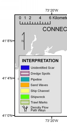

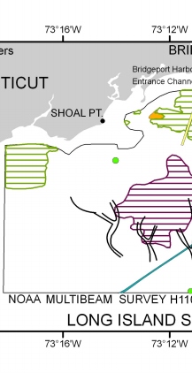
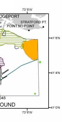
Interpretation of the sidescan-sonar mosaic (NOAA survey H11045) off Bridgeport, Connecticut. Interpretation of the sidescan-sonar mosaic (NOAA survey H11045) off Bridgeport, Connecticut. Interpretation of the sidescan-sonar mosaic (NOAA survey H11045) off Bridgeport, Connecticut.

Figure 6. Interpretation of the sidescan-sonar mosaic (NOAA survey H11045) off Bridgeport, Connecticut. Features are discussed in the text.


Skip past footer information

U.S. Department of Interior
> U.S. Geological Survey > Coastal and Marine Geology Program > Woods Hole Science Center

Disclaimer and Accessibility