Welcome to the USGS Woods Hole Science Center’s Sample Archive and Core Lab
The purpose of the Woods Hole Science Center's Sample Archive is to serve the scientific community through sample data storage and organization, to provide accurate answers to their inquiries regarding sample metadata, and to protect the physical integrity of these samples. We are committed to quality and organization in sample storage and retrieval for researchers. The archive maintains an up-to-date, accurate database so interested parties can find physical samples and metadata quickly.
Your comments are welcomed and any questions about the sample archive or sample requests can be directed to the curator.
Facilities and Sample Organization
The Core Lab consists of walk-in refrigerated and freezing cold rooms, and a laboratory and analysis facility. We are located at the Woods Hole Oceanographic Institution (WHOI) Quissett Campus, adjacent to the USGS Woods Hole Science Center's main office. The refrigerated room, designated RE01, maintains a temperature of +4º Celsius, and the freezer, designated FR01, maintains a temperature of –20º Celsius. These temperature-controlled facilities are designed to exclude the ambient environment, as fluctuations in air temperature and humidity can degrade the viability of the samples for geochemical and geophysical properties research, as well as promote organic growth. Dried samples that do not require special storage conditions are kept in the laboratory facility, designated as LAB, and long-term storage of dry samples is in our Marine Operations Facility, designated MOF.
Within each walk-in unit, located next to the main entrance is a schematic map designating storage sections into which each cold room has been divided (01 through 32 and C01 through C10 in the refrigerator, and 01 through 26 and C01 through C04 in the freezer). These sections contain shelving units, six shelves high (01 through 06, starting at the top).
These identifiers are combined to form a storage identification number, locally referred to as the Bucky Decimal System. An example is as follows:

This number identifies the location of the samples residing in refrigerated unit 01, section 02 of that unit, and shelf number 03 within section 02.
Samples are stored in durable plastic milk crates and are labeled with an informational tag identifying the samples inside as well as collection details and a storage identification number. These labels are placed in environmentally resistant plastic sleeves, which are attached to each milk crate.
Contributing Data to the Archive
Submission of data to the sample archive can be made in various ways. The recommended method is for researching parties to send electronically field data directly to the curator promptly after returning from the field. Spreadsheets can be sent, and a Microsoft Excel template is available in the navigation bar to the left. The data submitted in this form must be sent to the curator for addition to the preliminary inventory. These data will then be made available online to all parties for inquiry and accession of the physical samples.
Accessing the Collections
There are a variety of ways to search our holdings, including Google Earth, our Internet Mapping Server, and a text-based search of the data fields. These are all accessible above, in the toolbar on this page.
Text Searching
Users can search the database by field using the text-based search portal. This interface includes entry fields and drop down menus to search by sample type, location and principal investigator. This search links to the most recent update of the archive database.
Google Earth Search
A KML file is available to download and integrate into Google Earth for geographically searching the sample database. The KML file includes icons denoting the sample type and entry points are hyperlinked to individual webpages generated for each sample.
The Sample Archive IMS Portal
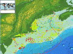
A new feature to search the database is the Coastal and Marine geology Internet Mapping Server. Data points can be searched visually or by querying the database, and data points are hyperlinked to webpages detailing the sample’s information. The data displayed on our IMS server are published in USGS Open-File Report 2006-1187 and have associated metadata. It is important to note that this does affect how up-to-date the searchable database is. New databases will be published as the archive continues to change and grow, but searchers should be mindful that data gathered through the Internet Mapping Server are dated.
Text Search the Archives by Field
|