Woods Hole Science Center
OFR 2005-1048 Home / Introduction / Geologic Setting / GIS Data Catalog / Bottom Photographs
U.S. Geological Survey Open-File Report 2005-1048
Geological Interpretation of Bathymetric and Backscatter Imagery of the Sea Floor Off Eastern Cape Cod, Massachusetts
|
|
Figure 29
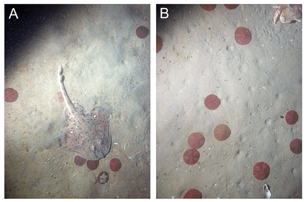
Bottom photographs showing top surfaces of erosional outliers of foreset beds associated with the Eastham outwash plain. Although draped by fine sand, preservation of these blocks indicates more cohesive sediments comprise the interiors. A) Skate and sand dollars on the undulating bottom at station
CC49. B) Tracks preserved in the finer grained sediments at station
CC50. Note crab partly visible in upper right. Long dimension of the sea-floor area shown is approximately 0.8 m. See
Figure 27 for station locations. |
|
|
|
|