
USGS Open File Report 2005-1066
 |
caribis - Caribbean Island Nations Coastline Boundaries |
Metadata also available as - [Questions
& Answers] - [Parseable text] - [XML]
Metadata:
- Identification_Information:
-
- Citation:
-
- Citation_Information:
-
- Originator: Glynn Williams
- Publication_Date: 2004
- Title: caribis - Caribbean Island Nations Coastline Boundaries
- Edition: 1.0
- Geospatial_Data_Presentation_Form: vector digital data
- Series_Information:
-
- Series_Name: Open-File Report
- Issue_Identification: 2005-1066
- Publication_Information:
-
- Publication_Place: Woods Hole Science Center, Woods Hole, MA
- Publisher: U.S. Geological Survey, Coastal and Marine Geology Program
- Online_Linkage:
-
<http://pubs.usgs.gov/of/2005/1066/data/boundaries/caribis/caribis.zip>
- Online_Linkage:
- Larger_Work_Citation:
-
- Citation_Information:
-
- Originator: Uri ten Brink
- Originator: Lt. Shep Smith
- Originator: Chuck Worley
- Originator: Thomas Stepka
- Originator: Glynn Williams
- Publication_Date: 2005
- Title:
-
Project PROBE Leg I - Report and Archive of Multibeam Bathymetry and Acoustic Backscatter, CTD/XBT and GPS Navigation Data Collected During USGS Cruise 02051 (NOAA Cruise RB0208) Puerto Rico Trench September 24, 2002 to September 30, 2002.
- Edition: 1.0
- Series_Information:
-
- Series_Name: Open-File Report
- Issue_Identification: 2005-1066
- Publication_Information:
-
- Publication_Place: Woods Hole Science Center, Woods Hole, MA
- Publisher: U.S. Geological Survey, Coastal and Marine Geology Program
- Other_Citation_Details: 1 DVD-ROM
- Online_Linkage: <http://pubs.usgs.gov/of/2005/1066/>
- Description:
-
- Abstract:
-
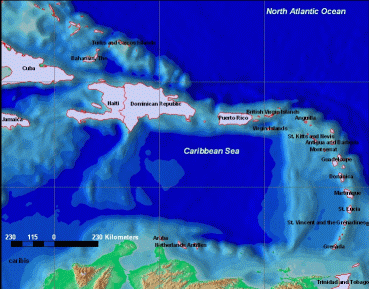
The Caribbean Island Nation data set is a shapefile polygon modeling the coastlines of the countries in the region. Shapefile format provides compatibility with georeferenced raster imagery used in a Geographic Information System (GIS). In addition, this data set provides a relational perspective view (s) in a GIS of the survey area surrounding the Puerto Rico trench.
- Purpose:
-
To supplement main featured mosaic image, the Puerto Rico trench survey area, in a GIS.
- Time_Period_of_Content:
-
- Time_Period_Information:
-
- Single_Date/Time:
-
- Calendar_Date: 1998
- Currentness_Reference: publication date
- Status:
-
- Progress: Complete
- Maintenance_and_Update_Frequency: None planned
- Spatial_Domain:
-
- Bounding_Coordinates:
-
- West_Bounding_Coordinate: -84.953339
- East_Bounding_Coordinate: -59.426949
- North_Bounding_Coordinate: 26.929165
- South_Bounding_Coordinate: 10.037498
- Keywords:
-
- Theme:
-
- Theme_Keyword_Thesaurus: General
- Theme_Keyword: U.S. Geological Survey
- Theme_Keyword: USGS
- Theme_Keyword: Coastal and Marine Geology Program
- Theme_Keyword: CMGP
- Theme_Keyword: Woods Hole Science Center
- Theme_Keyword: WHSC
- Theme_Keyword: coastline
- Theme_Keyword: vector shoreline
- Theme_Keyword: polygon shapefile
- Place:
-
- Place_Keyword_Thesaurus: General
- Place_Keyword: Caribbean Sea
- Place_Keyword: Anguilla
- Place_Keyword: Antigua
- Place_Keyword: Barbuda
- Place_Keyword: Aruba
- Place_Keyword: Bahamas
- Place_Keyword: Barbados
- Place_Keyword: British Virgin Islands
- Place_Keyword: Cayman Islands
- Place_Keyword: Cuba
- Place_Keyword: Dominica
- Place_Keyword: Dominica Republic
- Place_Keyword: Grenada
- Place_Keyword: Guadeloupe
- Place_Keyword: Haiti
- Place_Keyword: Jamaica
- Place_Keyword: Martinique
- Place_Keyword: Montserrat
- Place_Keyword: Netherlands Antilles
- Place_Keyword: Puerto Rico
- Place_Keyword: St Kitts
- Place_Keyword: Nevis
- Place_Keyword: St Lucia
- Place_Keyword: St Vincent
- Place_Keyword: Grenadines
- Place_Keyword: Trinidad
- Place_Keyword: Tobago
- Place_Keyword: Turks Islands
- Place_Keyword: Caicos Islands
- Place_Keyword: Virgin Islands
- Access_Constraints: None
- Use_Constraints:
-
Public domain data from the U.S. government are freely redistributable with proper metadata and source attribution.
- Point_of_Contact:
-
- Contact_Information:
-
- Contact_Organization_Primary:
-
- Contact_Organization: U.S. Geological Survey
- Contact_Person: Glynn Williams
- Contact_Position: Information Technician (Geo/GIS)
- Contact_Address:
-
- Address_Type: mailing and physical address
- Address: 384 Woods Hole Road
- City: Woods Hole
- State_or_Province: Massachusetts
- Postal_Code: 02543-2310
- Country: USA
- Contact_Voice_Telephone: (508) 548-8700 x2290
- Contact_Facsimile_Telephone: (508) 457-2310
- Contact_Electronic_Mail_Address: gwilliams@usgs.gov
- Hours_of_Service: 8:00AM to 5:00PM; M-F
- Native_Data_Set_Environment:
-
Microsoft Windows 2000 Version 5.1 (Build 2600) Service Pack 2; ESRI ArcCatalog 8.3.0.800
- Cross_Reference:
-
- Citation_Information:
-
- Originator: Uri ten Brink
- Originator: William Danforth
- Originator: Chris Polloni
- Originator: Castle Eugene Parker
- Originator: Toshi Uozumi
- Originator: Glynn Williams
- Publication_Date: 2004
- Title:
-
Project PROBE Leg II - Final Report and Archive of Swath Bathymetric Sonar, CTD/XBT and GPS Navigation Data Collected During USGS Cruise 03008 (NOAA Cruise RB0303) Puerto Rico Trench 18 February - 7 March, 2003
- Edition: 1.0
- Series_Information:
-
- Series_Name: Open-File Report
- Issue_Identification: 2004-1400
- Publication_Information:
-
- Publication_Place: Woods Hole Science Center, Woods Hole, MA
- Publisher: U.S. Geological Survey, Coastal and Marine Geology Program
- Other_Citation_Details: 1 DVD-ROM
- Online_Linkage: <http://pubs.usgs.gov/of/2004/1400/>
- Data_Quality_Information:
-
- Positional_Accuracy:
-
- Horizontal_Positional_Accuracy:
- Vertical_Positional_Accuracy:
- Lineage:
-
- Process_Step:
-
- Process_Description:
-
The desired area was selected as a subset from larger Caribbean Island vector data set found in ESRI's Data & Maps CD-ROM; 19990801.
- Process_Date: 20040723
- Process_Contact:
-
- Contact_Information:
-
- Contact_Person_Primary:
-
- Contact_Person: Glynn Williams
- Contact_Organization: U.S. Geological Survey
- Contact_Position: Information Technician (Geo/GIS)
- Contact_Address:
-
- Address_Type: mailing and physical address
- Address: 384 Woods Hole Road
- City: Woods Hole
- State_or_Province: Massachusetts
- Postal_Code: 02543-1598
- Country: USA
- Contact_Voice_Telephone: (508) 548-8700 x2290
- Contact_Facsimile_Telephone: (508) 457-2310
- Contact_Electronic_Mail_Address: gwilliams@usgs.gov
- Hours_of_Service: 8AM to 5PM; M-F
- Spatial_Data_Organization_Information:
-
- Direct_Spatial_Reference_Method: Vector
- Point_and_Vector_Object_Information:
-
- SDTS_Terms_Description:
-
- SDTS_Point_and_Vector_Object_Type: G-polygon
- Point_and_Vector_Object_Count: 24
- Spatial_Reference_Information:
-
- Horizontal_Coordinate_System_Definition:
-
- Geographic:
-
- Latitude_Resolution: 0.00001
- Longitude_Resolution: 0.00001
- Geographic_Coordinate_Units: Decimal degrees
- Geodetic_Model:
-
- Horizontal_Datum_Name: D_WGS_1984
- Ellipsoid_Name: WGS_1984
- Semi-major_Axis: 6378137.000000
- Denominator_of_Flattening_Ratio: 298.257224
- Vertical_Coordinate_System_Definition:
-
- Altitude_System_Definition:
- Depth_System_Definition:
- Entity_and_Attribute_Information:
-
- Detailed_Description:
-
- Entity_Type:
-
- Entity_Type_Label: caribis
- Entity_Type_Definition: Shapefile attribute table
- Entity_Type_Definition_Source: ESRI
- Attribute:
-
- Attribute_Label: FID
- Attribute_Definition: Internal feature number.
- Attribute_Definition_Source: ESRI
- Attribute_Domain_Values:
-
- Unrepresentable_Domain:
-
Sequential unique whole numbers that are automatically generated.
- Attribute:
-
- Attribute_Label: Shape
- Attribute_Definition: Feature geometry.
- Attribute_Definition_Source: ESRI
- Attribute_Domain_Values:
-
- Unrepresentable_Domain: Coordinates defining the features.
- Attribute:
-
- Attribute_Label: CNTRY_NAME
- Attribute_Definition: country name.
- Attribute_Definition_Source: ESRI
- Attribute_Domain_Values:
-
- Unrepresentable_Domain: Coordinates defining the features.
- Attribute:
-
- Attribute_Label: COUNT
- Attribute_Definition: the square miles of an area
- Attribute_Definition_Source: ESRI
- Attribute:
-
- Attribute_Label: FIRST_FIPS
- Attribute_Definition: First order of an abbreviation
- Attribute_Definition_Source: Federal Information Processing Standards (FIPS)
- Attribute:
-
- Attribute_Label: FIRST_REGI
- Attribute_Definition: First order name of a region
- Attribute_Definition_Source: Federal Information Processing Standards (FIPS)
- Attribute:
-
- Attribute_Label: FIRST_CONT
- Attribute_Definition: First order name of a continent
- Attribute_Definition_Source: Information Processing Standards (FIPS)
- Attribute:
-
- Attribute_Label: SUM_POP_AD
- Attribute_Definition: The administrative sum of a population
- Attribute_Definition_Source: Information Processing Standards (FIPS)
- Attribute:
-
- Attribute_Label: SUM_SQKM_A
- Attribute_Definition: The sum of the squared kilometer area
- Attribute_Definition_Source: Information Processing Standards (FIPS)
- Attribute:
-
- Attribute_Label: SUM_SQMI_A
- Attribute_Definition: The sum of the area measured in square miles
- Attribute_Definition_Source: Information Processing Standards (FIPS)
- Distribution_Information:
-
- Distributor:
-
- Contact_Information:
-
- Contact_Person_Primary:
-
- Contact_Person: Uri ten Brink
- Contact_Organization: U.S. Geological Survey
- Contact_Position: Research Scientist
- Contact_Address:
-
- Address_Type: mailing address
- Address: 384 Woods Hole Road
- City: Woods Hole
- State_or_Province: MA
- Postal_Code: 02543-1598
- Country: USA
- Contact_Voice_Telephone: (508) 548-8700 x2396
- Contact_Facsimile_Telephone: (508) 457-2310
- Contact_Electronic_Mail_Address: utenbrink@usgs.gov
- Resource_Description: Downloadable Data: Open-File Report 2005-1066
- Distribution_Liability:
-
Although these data are used by the U.S. Geological Survey, no warranty, expressed or implied, is made by the U.S. Geological Survey as to the accuracy of the data and related materials and (or) the functioning of the software. The act of distribution shall not constitute any such warranty, and no responsibility is assumed by the U.S. Geological Survey in the use of these data.
- Standard_Order_Process:
-
- Digital_Form:
-
- Digital_Transfer_Information:
-
- Format_Name: SHP
- Format_Version_Number: 3.2
- Format_Specification: ESRI polygon shapefile
- Format_Information_Content:
-
The individual files that comprise the shapefiles: caribis.dbf, caribis.prj, caribis.sbn, caribis.shp, and caribis.shx.
- File_Decompression_Technique: zip
- Transfer_Size: 12
- Digital_Transfer_Option:
-
- Offline_Option:
-
- Offline_Media: DVD-ROM
- Recording_Capacity:
-
- Recording_Density: 4,700
- Recording_Density_Units: Mbyte
- Recording_Format: UDF
- Fees: None
- Technical_Prerequisites:
-
The data is available in Environmental Systems Research Institute, Inc. (ESRI) shapefile format. The user must have ArcView 3.+ or ArcGIS 8.+ to read and process the data file. In lieu of ArcView/ArcGIS, the user may utilize another GIS application package capable of importing data.
- Metadata_Reference_Information:
-
- Metadata_Date: 20041102
- Metadata_Contact:
-
- Contact_Information:
-
- Contact_Organization_Primary:
-
- Contact_Organization: U.S. Geological Survey
- Contact_Person: Glynn Williams
- Contact_Position: Information Technician (Geo/GIS)
- Contact_Address:
-
- Address_Type: physical address
- Address: 384 Woods Hole Road
- City: Woods Hole
- State_or_Province: Massachusetts
- Postal_Code: 02543-1598
- Country: USA
- Contact_Voice_Telephone: (508) 548-8700 x2290
- Contact_Facsimile_Telephone: (508) 457-2310
- Contact_Electronic_Mail_Address: gwilliams@usgs.gov
- Hours_of_Service: 8:00AM to 5:00PM; M-F
- Metadata_Standard_Name: FGDC Content Standards for Digital Geospatial Metadata
- Metadata_Standard_Version: FGDC-STD-001-1998
- Metadata_Time_Convention: local time
- Metadata_Access_Constraints: None
- Metadata_Use_Constraints: None
- Metadata_Extensions:
-
- Online_Linkage: <http://www.esri.com/metadata/esriprof80.html>
- Profile_Name: ESRI Metadata Profile
Generated by mp version 2.8.6 on Fri Aug 26 14:37:07 2005
