USGS - science for a changing world

USGS Coastal and Marine Geology Program
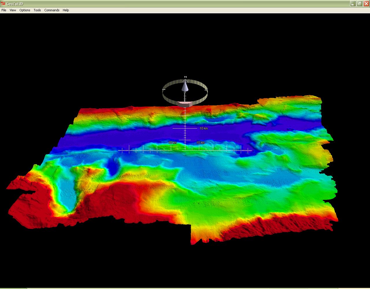
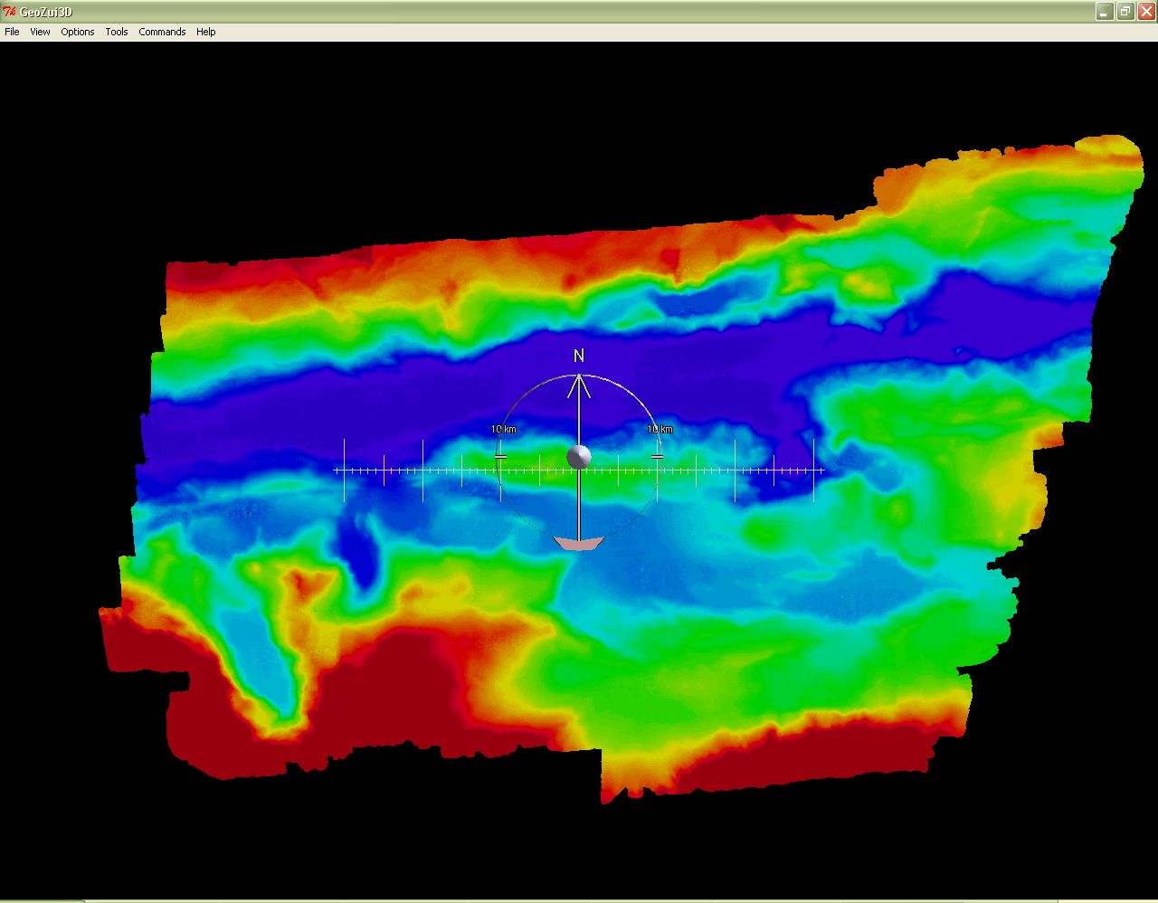
Project PROBE Leg I - Report and Archive of Multibeam Bathymetry and Acoustic Backscatter, CTD/XBT and GPS Navigation Data Collected, Puerto Rico Trench 24-30 September 2002
Skip past footer information
Home

Introduction

Cruise Data

GIS Data


3D Visualization

Acknowledgments

Contacts

Disclaimer

Readme

3D Visualization

This Open-File Report (2005-1066) DVD-ROM contains GeoZui a freeware product and interactive 3-D visualization system developed in the Center for Coastal and Ocean Mapping Program at the University of New Hampshire.


GeoZui3D Product Perspective Views


Oblique Perspective View

Nadir (birds-eye) Perspective View

3D Perspective View

Image of Oblique Perspective View. Image of Nadir (birds-eye) Perspective View. Image of 3D Perspective View.


View 1


View 2


View 3


Instructions:

GeoZui3D has the following features:

• A rapid zooming workspace interface whereby it is only necessary to click on
a point of interest for it to be moved to the center of the screen.
• Stereoscopic display
• Runs on both Unix and PC platforms
• Is fully georeferenced
• Real time data input from autonomous or remote vehicles is supported through CORBA.
• Can accept Multiple objects of different types can be viewed simultaneously


How to Get a Perspective View of Trench Data

At the GUI widget (window), from the file menu, select "Open Object" then navigate to the place on this DVD, that is, “data/multibeam/Geozuidata/data/products” and open the file type ending in “.gutm.” A scene will load with the featured data from the trench; the deepest part of the Atlantic Ocean (Caribbean Sea) will be loaded and ready for use; manipulative viewing and other options are available to explore. The 4 main featured imagery (acoustic backscatter and multibeam bathymetry) files contained in the multibeam subfolder on this DVD are documented with metadata.


Image of GUI I.

GUI I


Image of GUI II.

GUI II


Refer to GeoZui3D Readme file (instructions) if technical difficulties occur or see your Systems Administrator

  1. Navigate to the subfolder "../data/multibeam/GeozuiData/bin" on this disc and execute the application file GeoZui3D (1,088 kb size)
  2. Click OK to GUI I (Not shown here)
  3. Use the other two, GUI II and GUI III
  4. Load your data and explore
Skip Navigation

Accessibility FOIA Privacy Policies and Notices

U.S. Department of the Interior | U.S. Geological Survey | Coastal and Marine Geology

URL: cmgds.marine.usgs.gov/publications/of2005-1066/htmldocs/geozui3d.htm
Page Contact Information: CMGDS Team
Page Last Modified: Wednesday, 06-Dec-2017 12:36:18 EST