USGS Coastal and Marine Geology Program
![]() Title | Introduction
| Methods | Reconnaissance Bathy |
Interpolated Bathy | Catalog
| Acknowlegments | References
| Figures
| Contacts
Title | Introduction
| Methods | Reconnaissance Bathy |
Interpolated Bathy | Catalog
| Acknowlegments | References
| Figures
| Contacts
 |
||
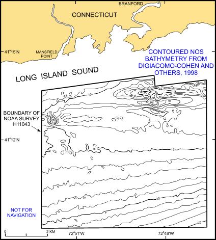
Figure 2. Example of a portion of the 1-m contoured bathymetry from DiGiacomo-Cohen and others (1998). Example shows the bathymetry within the boundary of NOAA survey H11043. | ||
