USGS Coastal and Marine Geology Program
Title Page /
Table of Contents /
Introduction /
Geographic Information System /
References /
Acknowledgements
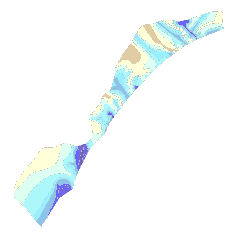
Onshore_con: Image of the onshore contours showing depth to the base of the Quaternary section as stored within ArcGIS Map Document. | ||
 |
||
