USGS Coastal and Marine Geology Program
Title Page /
Table of Contents /
List of Figures /
Introduction /
Maps / Data Collection/Processing / Interpretation / Acknowledgments / Appendix 1 / Appendix 2 /
Appendix 3 /
 |
||
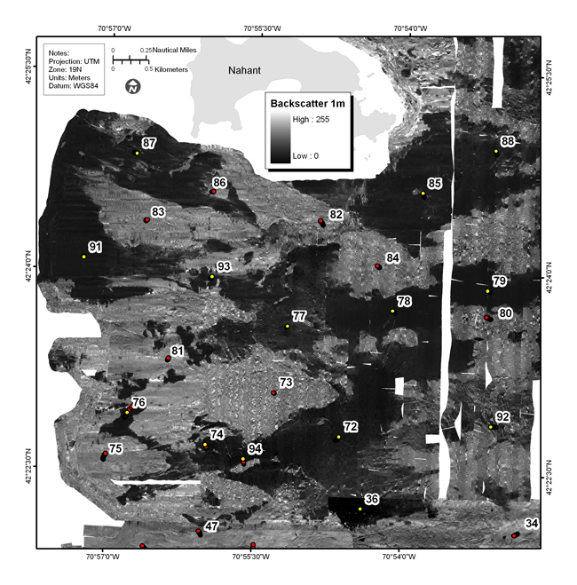
Figure 4.14b. Backscatter intensity from sidescan-sonar of the Approaches to Boston Harbor, north of the Harbor Islands and south of Nahant, including Broad Sound (see fig. 4.2 for map location). The sea floor in this region is characterized by elevated rough areas, some of which are hypothesized to be drumlins reworked by rising sea level. Red dots show location of bottom photographs (see Appendix 3 to view all photographs at these locations); yellow dot is location of bottom sediment sample (Appendix 2); number is station identifier. See Figure 4.14a for companion shaded-relief map. | ||
