USGS Coastal and Marine Geology Program
Title Page /
Table of Contents /
List of Figures /
Introduction /
Maps / Data Collection/Processing / Interpretation / Acknowledgments / Appendix 1 / Appendix 2 /
Appendix 3 /
 |
||
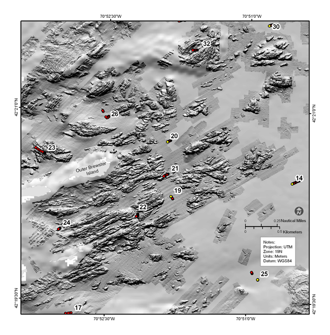
Figure 4.16a. Shaded-relief bathymetric map showing outcropping ledges east of the Brewster Islands (see fig. 4.2 for map location). The darker patches indicate the areas where multibeam bathymetry was collected and the data gridded at 2 m; the rest of the area was mapped by single-beam sonar and the data gridded at 30 m. These ENE-WSW-trending features exhibit the largest topographic variability in the study area. See Figure 4.16b for companion sidescan sonar image. | ||
