USGS Coastal and Marine Geology Program
Title Page /
Table of Contents /
List of Figures /
Introduction /
Maps / Data Collection/Processing / Interpretation / Acknowledgments / Appendix 1 / Appendix 2 /
Appendix 3 /
 |
||
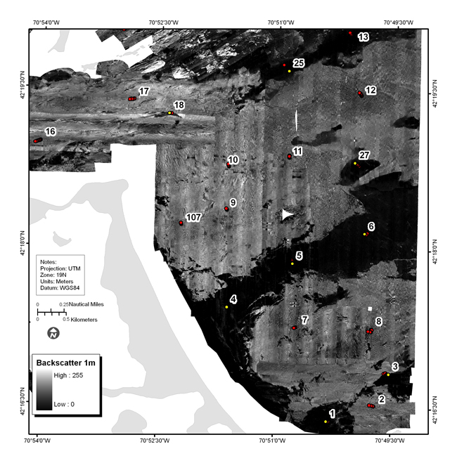
Figure 4.17b. Backscatter intensity from sidescan-sonar of area east of Nantasket Beach (see fig. 4.2 for location). The elevated areas are characterized by high backscatter intensity and the sand ribbon by low backscatter intensity. Red dots show location of bottom photographs (see Appendix 3 to view all photographs at these locations); yellow dot is location of bottom sediment sample (Appendix 2); number is station identifier. See Figure 4.17a for companion shaded-relief map. | ||
