USGS Coastal and Marine Geology Program
Title Page /
Table of Contents /
List of Figures /
Introduction /
Maps / Data Collection/Processing / Interpretation / Acknowledgments / Appendix 1 / Appendix 2 /
Appendix 3 /
 |
||
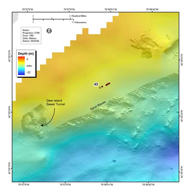
Figure 4.8. Shaded-relief bathymetry, colored by water depth, showing sand waves along the northern side of the navigation channel south of Deer Island (see fig. 4.2 for map location). The sand waves are less than a meter high and have wavelengths of about 10 m. Red dots show location of bottom photographs (see Appendix 3 to view all photographs at these locations); yellow dot is location of bottom sediment sample (Appendix 2); number is station identifier. | ||
