USGS Coastal and Marine Geology Program
![]() Title | Geologic Setting | Introduction
| Methods | Bathymetric Overview |
Interpretation | Data Catalog
| Acknowledgments | References
| Figures
| Contacts
Title | Geologic Setting | Introduction
| Methods | Bathymetric Overview |
Interpretation | Data Catalog
| Acknowledgments | References
| Figures
| Contacts
 |
||
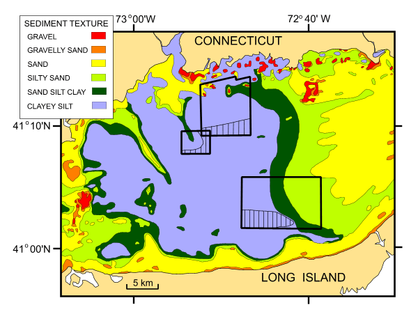
Figure 12. Map from Poppe and others (2000a) showing the distribution of surficial sediments in east-central Long Island Sound. Map also shows the locations of NOAA surveys H11043 and H11255, the USGS CLIS Dumping Ground survey, and the areas within those surveys where sedimentary furrows have been observed to occur (hatched areas). Note that sedimentary furrows only occur within areas characterized by muddy sediments. | ||
