USGS Coastal and Marine Geology Program
![]() Title |
Figures |
1-Introduction |
2-Data Collection and Processing |
3- Geologic Interpretation |
4-References |
5-Maps |
Spatial Data |
Acknowledgments
Title |
Figures |
1-Introduction |
2-Data Collection and Processing |
3- Geologic Interpretation |
4-References |
5-Maps |
Spatial Data |
Acknowledgments
 |
||
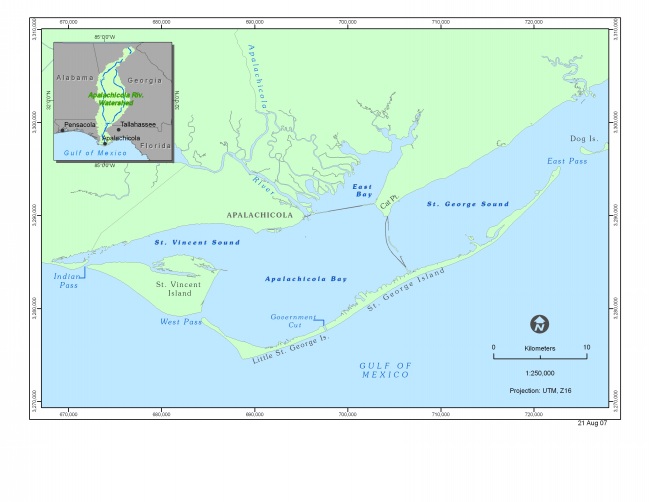
Figure 1. Map of Apalachicola Bay identifying regional geographic locations, physiographic features, and water bodies. Inset illustrates the location of the bay within the southeastern United States. | ||
