
Woods Hole Science Center
![]() Title |
Introduction |
Setting |
Methods |
Results |
Discussion |
Data Catalog |
Acknowledgments |
References |
Figures |
Contacts
Title |
Introduction |
Setting |
Methods |
Results |
Discussion |
Data Catalog |
Acknowledgments |
References |
Figures |
Contacts
 |
||
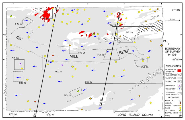
Figure 15. Geological interpretation of the bathymetry from survey H11361 in the eastern part of the study area around Six Mile Reef. Arrows show directions of net sediment transport based on sand-wave and scour-mark asymmetry. Also shown are locations of the seismic profiles shown in figures 17, 18, 19, and 24, and detailed multibeam views of the sea floor shown in figures 20, 25, 26, 27, 28, 29, 31, 32, 33, and 35. See insets for explanation of symbols. | ||


