
Woods Hole Science Center
![]() Title |
Introduction |
Setting |
Methods |
Results |
Discussion |
Data Catalog |
Acknowledgments |
References |
Figures |
Contacts
Title |
Introduction |
Setting |
Methods |
Results |
Discussion |
Data Catalog |
Acknowledgments |
References |
Figures |
Contacts
 |
||
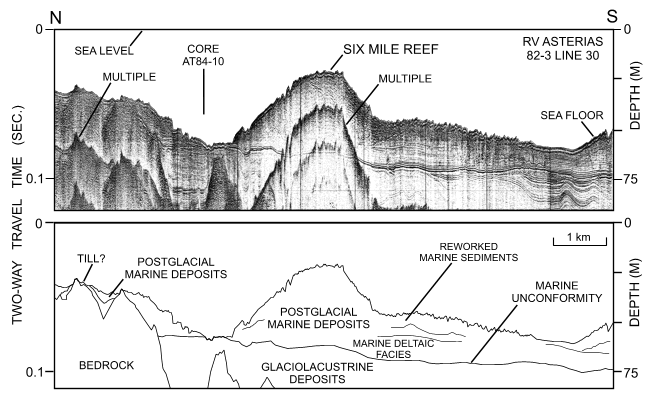
Figure 17. Uniboom seismic-reflection profile across the eastern part of Six Mile Reef (RV Asterias 82-3; line 30). Profile shows that glaciolacustrine deposits are exposed to the north. Note location of core AT84-10 (Poppe and others, 2002b). Location of seismic profile and core location are shown in figure 15. | ||


