
Woods Hole Science Center
![]() Title |
Introduction |
Setting |
Methods |
Results |
Discussion |
Data Catalog |
Acknowledgments |
References |
Figures |
Contacts
Title |
Introduction |
Setting |
Methods |
Results |
Discussion |
Data Catalog |
Acknowledgments |
References |
Figures |
Contacts
 |
||
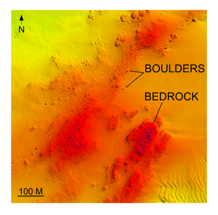
Figure 20. Detailed planar view of multibeam bathymetry from survey H11361 showing exposed bedrock and till. Boulder fields reveal offshore extension of the Old Saybrook moraine north of Six Mile Reef. Location of detailed view is shown in figure 15. | ||


