
Woods Hole Science Center
![]() Title |
Introduction |
Setting |
Methods |
Results |
Discussion |
Data Catalog |
Acknowledgments |
References |
Figures |
Contacts
Title |
Introduction |
Setting |
Methods |
Results |
Discussion |
Data Catalog |
Acknowledgments |
References |
Figures |
Contacts
 |
||
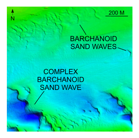
Figure 25. Detailed planar view of multibeam bathymetry from survey H11361 showing barchanoid sand waves northeast of the shoal suggesting net transport to the west. Location of detailed view is shown in figure 15. | ||


