
Woods Hole Science Center
Sidescan-Sonar Imagery and Surficial Geologic Interpretations of the Sea Floor in Central Rhode Island Sound
![]() Title |
Introduction |
Geologic Setting |
Data Acquisition/Processing |
Bathymetry |
Seismic Reflection Data |
Sidescan Sonar Imagery |
Environments |
Discussion |
Summary |
GIS Data Catalog |
Acknowledgments |
References |
Figures |
Contacts
Title |
Introduction |
Geologic Setting |
Data Acquisition/Processing |
Bathymetry |
Seismic Reflection Data |
Sidescan Sonar Imagery |
Environments |
Discussion |
Summary |
GIS Data Catalog |
Acknowledgments |
References |
Figures |
Contacts
 |
||
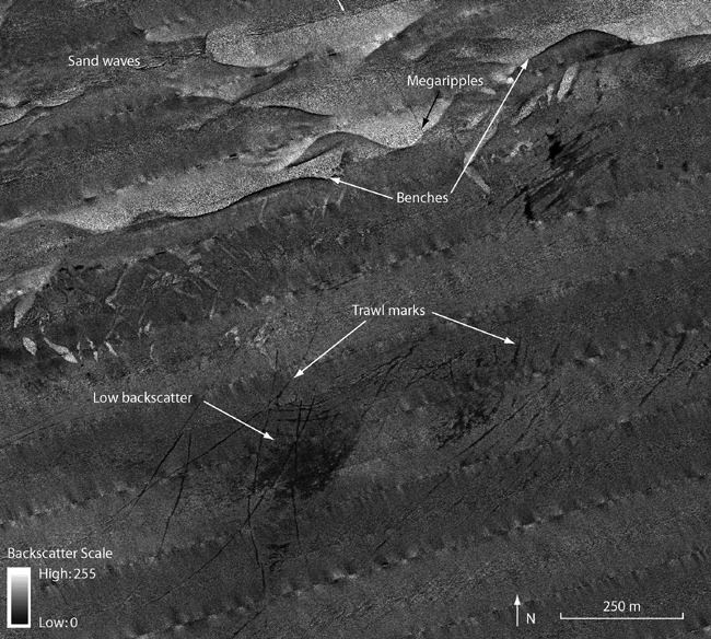
Figure 12. Detailed sidescan-sonar image of trawl marks on the floor of the channel. Lines of low backscatter or paired high and low backscatter indicate trawl marks. Benches cross the northern part of the image where there is a sharp curvilinear change in backscatter and sand waves are located throughout the north. An area of low backscatter indicates finer grained sediment. Location of figure shown in fig. 2. | ||

