
Woods Hole Science Center
Sea-Floor Character and Sedimentary Processes in the Vicinity of Woods Hole, Massachusetts
![]() Title | Abstract | Introduction | Setting | Methods | Bathymetry and Backscatter | Seismic Profiles | Character and Processes | Data Catalog | Acknowledgments | References | Figures | Bottom Photography | Sediment Data | Contacts
Title | Abstract | Introduction | Setting | Methods | Bathymetry and Backscatter | Seismic Profiles | Character and Processes | Data Catalog | Acknowledgments | References | Figures | Bottom Photography | Sediment Data | Contacts
 |
||
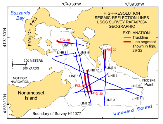
Figure 11. Map showing the locations of the tracklines (blue lines) along which the chirp high-resolution seismic-reflection data were collected during the November 2007 Rafael 07034 cruise and the locations of line segments shown in figures 29-32 (red segments). | ||


