
Woods Hole Science Center
Sea-Floor Character and Sedimentary Processes in the Vicinity of Woods Hole, Massachusetts
![]() Title | Abstract | Introduction | Setting | Methods | Bathymetry and Backscatter | Seismic Profiles | Character and Processes | Data Catalog | Acknowledgments | References | Figures | Bottom Photography | Sediment Data | Contacts
Title | Abstract | Introduction | Setting | Methods | Bathymetry and Backscatter | Seismic Profiles | Character and Processes | Data Catalog | Acknowledgments | References | Figures | Bottom Photography | Sediment Data | Contacts
 |
||
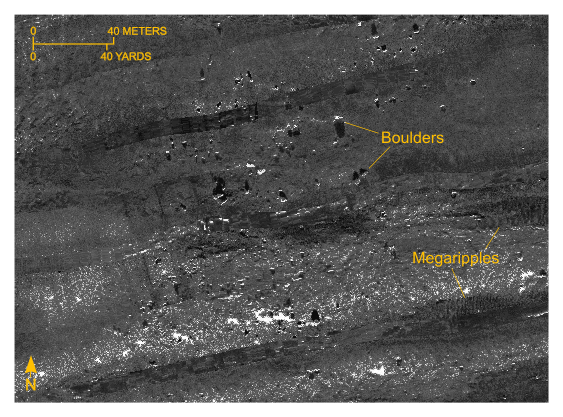
Figure 26. Detailed planar view southeast of Great Ledge of the sidescan-sonar mosaic produced during National Oceanic and Atmospheric Administration survey H11077 of Woods Hole, Massachusetts. View shows high-backscatter targets interpreted to be boulders. Note small patches of megaripples. Location of view is shown in figure 19. | ||


