
Woods Hole Science Center
Interpolation of Reconnaissance Multibeam and Single-Beam Bathymetry Offshore of Milford, Connecticut
![]() Title |
Introduction |
Methods |
Reconnaissance Bathymetry |
Interpolated Bathymetry |
GIS Data Catalog |
Acknowledgments |
References |
List of Figures |
Contacts
Title |
Introduction |
Methods |
Reconnaissance Bathymetry |
Interpolated Bathymetry |
GIS Data Catalog |
Acknowledgments |
References |
List of Figures |
Contacts
 |
||
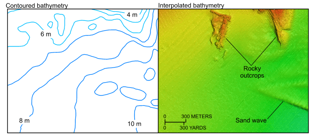
Figure 8. Detailed views of the contoured (left) and interpolated (right) bathymetry from National Oceanic and Atmospheric Administration survey H11044 south of Charles Island. Note the improved resolution of the rocky outcrops in the interpolated image. Location of view is shown in figure 2. | ||


