
Woods Hole Science Center
![]() Title |
Introduction |
Geologic Setting |
Data Acquisition/Processing |
Bathymetry |
Seismic-Reflection Data |
Sidescan-Sonar Imagery |
Environments |
Sea-Floor Geology |
Summary |
GIS Data Catalog |
Acknowledgments |
References Cited |
Figures |
Contacts
Title |
Introduction |
Geologic Setting |
Data Acquisition/Processing |
Bathymetry |
Seismic-Reflection Data |
Sidescan-Sonar Imagery |
Environments |
Sea-Floor Geology |
Summary |
GIS Data Catalog |
Acknowledgments |
References Cited |
Figures |
Contacts
 |
||
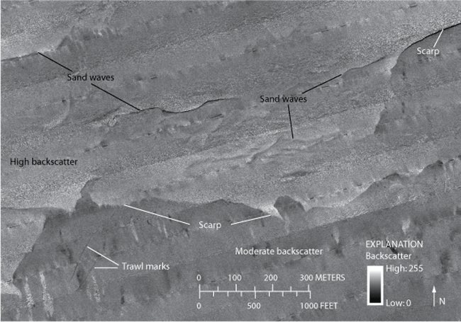
Figure 10. Detailed sidescan-sonar image of an area containing scarps, which show a sharp contrast in backscatter that continues along most of the southern slope of the eastern bathymetric high. Sand waves, oriented generally east-west, and higher backscatter are observed north of the scarp. Trawl marks can be seen in the area of moderate backscatter south of the scarp. Location of image shown in figure 2. | ||

