
Woods Hole Science Center
![]() Title |
Introduction |
Geologic Setting |
Data Acquisition/Processing |
Bathymetry |
Seismic-Reflection Data |
Sidescan-Sonar Imagery |
Environments |
Sea-Floor Geology |
Summary |
GIS Data Catalog |
Acknowledgments |
References Cited |
Figures |
Contacts
Title |
Introduction |
Geologic Setting |
Data Acquisition/Processing |
Bathymetry |
Seismic-Reflection Data |
Sidescan-Sonar Imagery |
Environments |
Sea-Floor Geology |
Summary |
GIS Data Catalog |
Acknowledgments |
References Cited |
Figures |
Contacts
 |
||
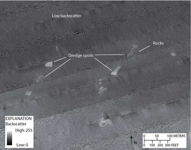
Figure 12. Detailed sidescan-sonar image showing dredge spoils in the southwestern part of the study area. An area of low backscatter can be seen in the northern part of the image. Boulders, characterized by high-backscatter targets with low-backscatter shadows, comprise some of the dredge spoils. Location of image shown in figure 2. | ||

