
Woods Hole Science Center
![]() Title |
Introduction |
Geologic Setting |
Data Acquisition/Processing |
Bathymetry |
Seismic-Reflection Data |
Sidescan-Sonar Imagery |
Environments |
Sea-Floor Geology |
Summary |
GIS Data Catalog |
Acknowledgments |
References Cited |
Figures |
Contacts
Title |
Introduction |
Geologic Setting |
Data Acquisition/Processing |
Bathymetry |
Seismic-Reflection Data |
Sidescan-Sonar Imagery |
Environments |
Sea-Floor Geology |
Summary |
GIS Data Catalog |
Acknowledgments |
References Cited |
Figures |
Contacts
 |
||
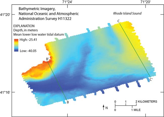
Figure 6. Bathymetric image of National Oceanic and Atmospheric Administration survey H11322 in western Rhode Island Sound. Bathymetric highs are located in the northwest, northeast, and southwest. Channels lie between the northern bathymetric highs and across their southern boundaries. Green lines indicate locations of seismic-reflection profiles B-B' and C-C', shown in figures 7 and 8, respectively. | ||

