USGS Coastal and Marine Geology Program
Geophysical Data from Offshore of the Chandeleur Islands, Eastern Mississippi Delta
![]() Title Page /
Contents /
Introduction /
Data Acquisition and Processing Overview /
Geographic Information System Data Catalog /
Acknowledgments /
References Cited
Title Page /
Contents /
Introduction /
Data Acquisition and Processing Overview /
Geographic Information System Data Catalog /
Acknowledgments /
References Cited
 |
||
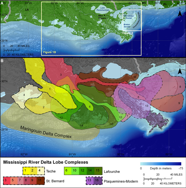
| Figure 1. (A) Inset map of the Mississippi Delta region including surrounding portions of coastal Louisiana, Mississippi, Alabama, and Florida. (B) Schematic diagram of Mississippi Delta Complex sublobes (colored and outlined polygons) showing the relative timing (1-16) of their development (modified from Penland and others, 2002). The Chandeleur Islands lie on the eastern edge of the Mississippi Delta (also see fig. 2), and are associated with the St. Bernard sublobe, which formed between approximately 4,600 and 1,800 years BP. | ||
