Woods Hole Science Center
A GIS Library of Multibeam Data for Massachusetts Bay and the Stellwagen Bank National Marine Sanctuary, Offshore of Boston, Massachusetts, USGS DS 99; Version 1.0
|
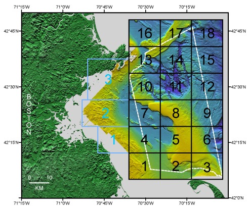
Figure 1a. Boundaries of Stellwagen Bank (1-18 in black) and western Massachusetts Bay (1-3 in blue) map series quadrangles superimposed on shaded relief topography colored by water depth. The boundary of the Stellwagen Bank National Marine Sanctuary is shown in white.
Download Adobe Reader to read PDF documents. |
Any use of trade names is for descriptive purposes only and does not imply endorsement by the U.S. Government.