USGS Coastal and Marine Hazards and Resources Program
Title Page /
Table of Contents /
List of Figures /
Introduction /
Maps / Data Collection/Processing / Interpretation / Acknowledgments / Appendix 1 / Appendix 2 /
Appendix 3 /
 |
||
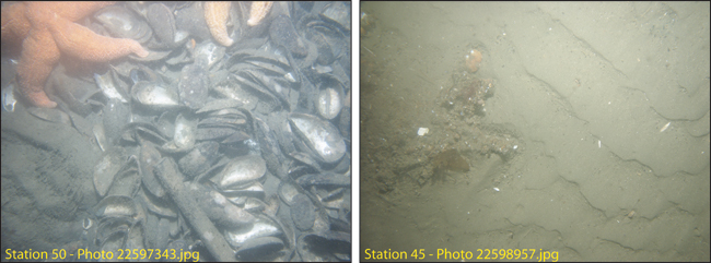
Figure 4.13. Photographs of the sea floor in the south Channel (station 50) and in a small area of low backscatter intensity southeast of Deer Island (station 45). See Figure A3.1 for station locations locations. See Appendix 3 for additional photographs at these stations. The field of view of each image is approximately 50 cm wide. | ||
