USGS Coastal and Marine Hazards and Resources Program
Title Page /
Table of Contents /
List of Figures /
Introduction /
Maps / Data Collection/Processing / Interpretation / Acknowledgments / Appendix 1 / Appendix 2 /
Appendix 3 /
 |
||
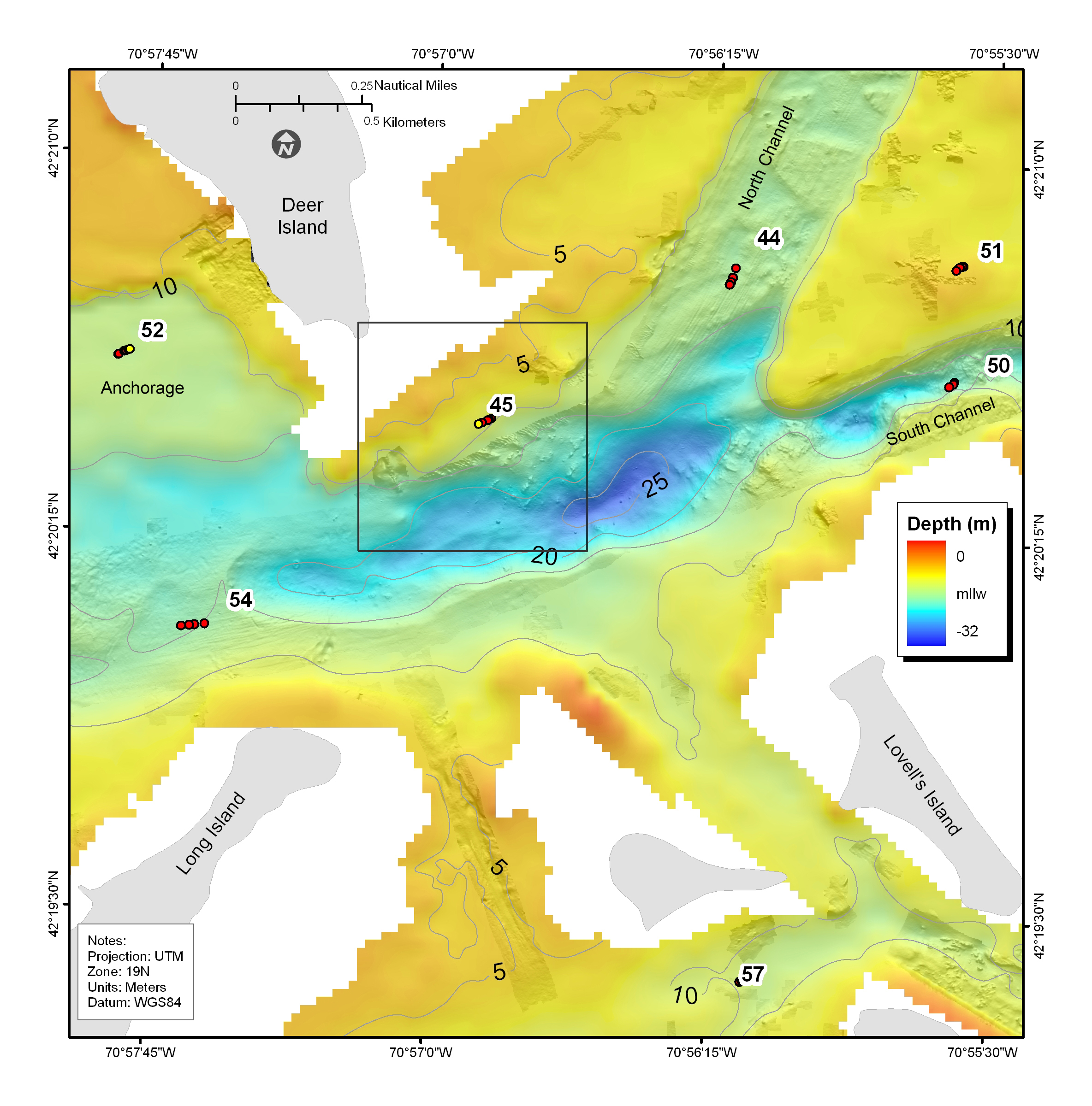
Figure 4.7. Shaded-relief bathymetry, colored by water depth, of the depression south of Deer Island where the deepest water in Boston Harbor occurs (about 28 m deep). See Figure 4.2 for map location. Red dots show location of bottom photographs (see Appendix 3 to view all photographs at these locations); yellow dot is location of bottom sediment sample (Appendix 2); number is station identifier. | ||
