USGS - science for a changing world

USGS Coastal and Marine Geology Program

High-Resolution Geologic Mapping of the Inner Continental Shelf: Boston Harbor and Approaches, Massachusetts

Title Page / Table of Contents / List of Figures / Introduction / Maps / Data Collection/Processing / Interpretation / Acknowledgments / Appendix 1 / Appendix 2 / Appendix 3 /


Figure A2.1. Texture of surficial sediment collected in grab samples shown on ternary diagrams.

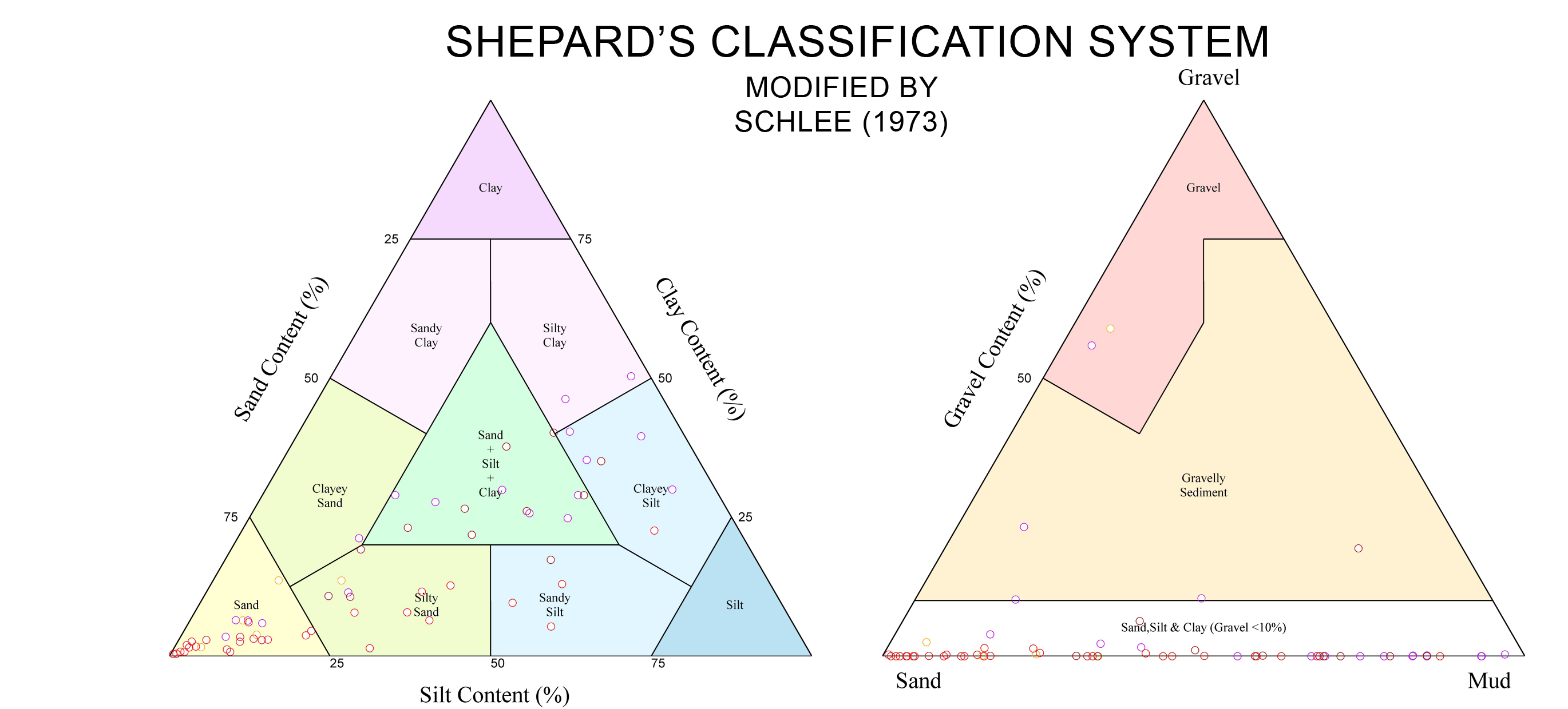
Figure A2.1. Texture of surficial sediment collected in grab samples shown on ternary diagrams.  The stations are keyed to the map units (see fig. 4.21).  Texture of the rough sea-floor zones is not represented, as samples could not be collected in areas of boulders or gravel pavement.

Click here for a larger JPG image

Skip Navigation

Accessibility FOIA Privacy Policies and Notices

U.S. Department of the Interior | U.S. Geological Survey | Coastal and Marine Geology

URL: cmgds.marine.usgs.gov/publications/of2006-1008/html/imagepages/fa2_1.html
Page Contact Information: CMGDS Team
Page Last Modified: Wednesday, 06-Dec-2017 12:55:27 EST