
Woods Hole Science Center
Geologic Interpretation and Multibeam Bathymetry of the Sea Floor in the Vicinity of the Race, Eastern Long Island Sound
![]() Title |
Introduction |
Setting |
Methods |
Results |
Discussion |
Data Catalog |
Acknowledgments |
References |
Figures |
Contacts
Title |
Introduction |
Setting |
Methods |
Results |
Discussion |
Data Catalog |
Acknowledgments |
References |
Figures |
Contacts
 |
||
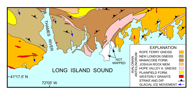
Figure 2. Bedrock geologic map of the area onshore from NOAA survey H11250 simplified from Rodgers (1985). Image shows directions of glacial ice movement (blue arrows; Goldsmith, 1962) and the Avalonian anticlinorium. | ||


